Track info.

Click on any picture with a border for a larger view!

Now  for most of my trails you can download my GPS track (bread crumb trail) as well as the map of my track. For more info Click Track Info


My tracks are made with a Garmin GPS model GPS map 162 using Garmin’s MapSource.  Makes a file “trailname.mps”
if you have a Garmin GPS with a computer interface you should be able to load my track into your GPS. There are other maping software that can use Garmin tracks but I am not sure what they are.
I have also included a map of the trail for you to print out in.
Map is in  .JPG format.

Look for this to download a Track. \/

Download track of Broad Canyon now

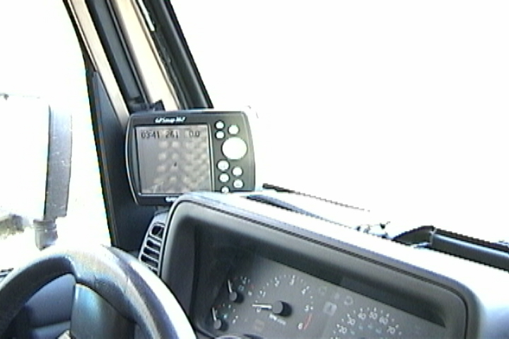
I use a Garmin GPS model # 162 using Garmin’s MapSource. There are several reasons I chose the 162 over the III +;
   The screen is 5 ¼ inches versus the III+ 3 inch screen(easier to see while driving)
   Comes with all the extras (external antenna, 117V power, 12V Power, computer cable)
   More memory
For $50 bucks more than the III+ with the extras.  But like I said you get a 5 ¼ inch screen.
 
Garman has several types of map CDs available. Street, recreation and topo.
   The street CDs have streets and restaurants hotels…
   The recreation CDs has more trails, Hiking Jeep, ATV and fishing, hunting…
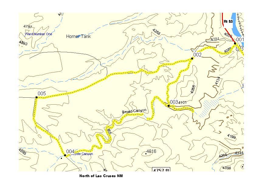
.
   The topo CDs has most of the roads and trails, and more topo info.
 
I use the Garmin MapSource Topo CDs.  
 
If you have a Garmin GPS with a computer interface you should be able to up-load my track into your GPS

[Video, Jeeping 101]

[Welcome page]

[Track info.]

The Odyssey

[Odyssey] [Day 8-14] [Day 15 -21] [Day 22 - 28] [Day 29 - 35] [Day 36 - 42] [Day 43 - 49]

[City Answers] [Foliage Answers]

Articles

[the shaft] [airing down] [Salsa] [Air Compressor] [Cooking Meatloaf]

[Trails]

[Choke Cherry] [Holy Cross] [Death Valley] [Chili Challenge] [Caballo Mts] [Gila NF Trip] [Titus Canyon]

[Woodpecker Mine]  [Picket Post]  [Box Canyon]

E-mail chris@seetheusabyjeep.com


E-mail Support@seetheusabyjeep.com